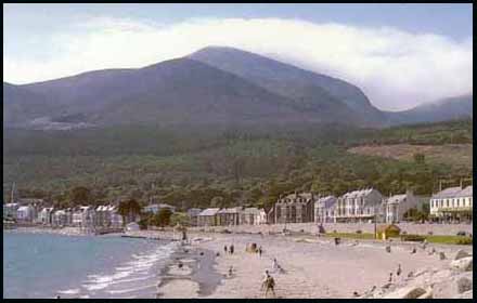
Ros Davies' Co. Down, Northern Ireland Family History Research Site
© Rosalind Davies 2001
Permission granted to reprint research for non-profit use only
Surnames |Place Names | Churches | Photos | Maps | | Ships | Schools | The Famine | Articles & Misc
What's New | Links | Message Board | Site Notes/Codes | Email |Home

Newcastle town in Kilcoo parish

Newcastle Newcastle & Slieve Donard Church of Ireland, Newcastle Tullybrannigan Church of Ireland & graveyard
Newcastle Presbyterian Church Newcastle Catholic Church Elim Pentecostal Church, Newcastle Newcastle Methodist


click here for the photos & information on other areas of Kilcoo parish

Newcastle town
on the coast 4km SE of Castlewellan


The Promenade, Newcastle. These three lovely old postcards were kindly sent by Vernon Moore Black Rock, at the far end of Newcastle. Now the site of the swimming pool . Several aspects of old Newcastle.


The town's name is from the new castle or fortress ' an caislean nua' built by Felix Magennis in 1588 . It was a substantial tower house and was his seaside residence. It was burnt by Scots in 1643 then rebuilt by William Hawkins; New-Castle. This was the period when the gradual decline of the Anglo-Norman settlements in Down was balanced by the increasing influence of the Gaelic Magennises, Lords of Iveagh.. In 1747 Anthony Magennis sold this tower house and surrounding property in the townland of Ballaghbeg to the Hon. William Annesley and from then on the town followed the fortunes of the Annesley family. The tower house was used by the coastguard for many years then demolished in 1830.


In the early 19th century , Newcastle would have appeared to be little more than a village with a tower house, with a few fishermen's huts scattered along the beach. Mrs. Delany, the wide of the Dean of Down, wrote in 1744," at the foot of a range of mountains so high that they are seldom free from clouds, and the water has made a winding channel and falls down a cascade... On the other bank are hills, fine meadows, winding rivers and a variety of pretty objects for a country so bare of trees. This country is famous for the goats' whey; and at the season for drinking it, which is summer, a great deal of company meet for that purpose and there are little huts built up for their reception and they have music and balls and cards."


This photo was kindly sent by Pete Meaney. It shows the main street of Newcastle looking south to the Mourne Mountains.

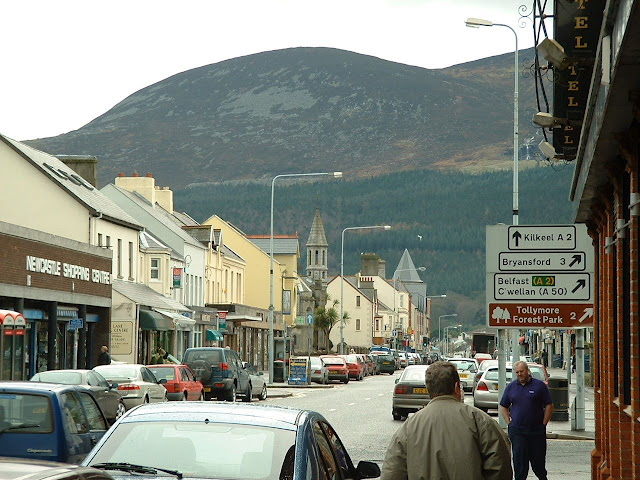
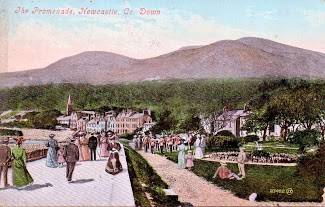
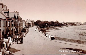
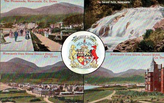
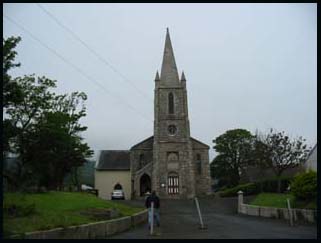
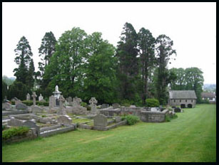
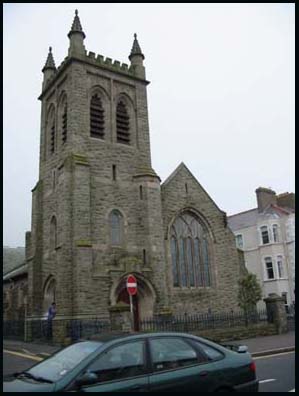
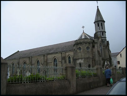
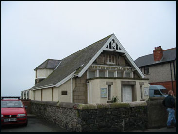
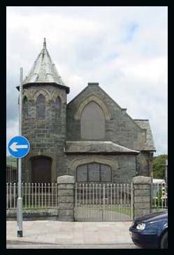
Lord Annesley built a pier in late 1820s but it was never a favourite port for larger vessels. It was mainly a base for fishermen and the coastguard. I n 1836 there was a Church of Ireland & a Catholic chapel, and a school in town .The Catholic Parochial House is here. The fishing disaster of 1843 when 46 men from Newcastle & 27 from Annalong perished in a hurricane. Widow's Row, near the habour,was built to accommodate the grieving families. 1830 really marks the start of Newcastle's development in the 19th century for in that year the 3rd Earl decided to build a' marine residence' for himself and growing family at Newcastle. This was a large two-storey house built of granite on the slopes of Slieve Donard, great views of Dundrum Bay and called Donard Lodge. Lord Annesley also considered how Newcastle could be developed as a resort. At this time there were only 160 houses in the village which were simply thatched and whitewashed cottages. There was a Methodist meeting-house, a police barracks, a Post Office kept by James Hyland , several shops and public houses (like George Mulligan's) ,a Hibernian Society School run by Miss Martha McKegney and a cluster of fishermen's huts in King Street. The population in 1831 was 987 people. The first improvement was the erection of the Annesley Arms Hotel on the site of the old Magennis castle. Nearby a bath-house and a pavilion were built, then an Anglican church and a stone pier. Cottiers and fishermen were discouraged from living there. By 1850 Newcastle was recognised as one of the best resorts for the gentry.

The railway from Belfast opened on 26th March 1869 and this brought new prosperity to Newcastle. ( Email me for a photo of the railway station c. 1900 ( 27 Mar 1967R,DR*). More hotels were built, with the magnificent Slieve Donard Hotel opening on the 21st June 1898. It continued to be a major resort town and still is today. Cultural Feis organised here Jul 1904 (LR 2005 p49-54). The population in 1910 was 1553 people. (POD) Newcastle during Second World War (LR 2013 p9-12)

There is an article in Lecale Miscellany 2002 about the lifeboat crews of Newcastle & Dundrum Bay.

articles from Down Recorder newspaper;
Temperance Tea Party; 31 Dec 1836; Temperance Meeting; 25 Mar 1837; Newcastle Hotel 13 May 1837; new pier 28 Aug 1841; fishing calamity 21 & 28 Jan 1843*; mussel gatherers deaths 8 Feb 1845*; funds from government to repair Newcastle pier as part of famine relief measures 17 Oct 1846*; article 18 Sep 1852; evictions from Widow's Row 18 Aug 1855*; lime kilns 29 May 1858; Anchor Hotel 17 Jul 1858; Annesley Arms Hotel 23 Jun 1860; public cemetery 31 Jul 1869; Rock Cottage to be sold 24 Jun 1871; description of the town 26 Jul 1879 opening of new Masonic Hall 9 Oct 1924*; photo of lifeboat parade along Central Pomenade, Newcastle 1920s (2/4/67R); Urban Council meeting re warship in Dundrum Bay 21 Nov 1936*; Newcastle Physical Training display 4 Jun 1939*

article from Mourne Observer newspaper;
Great Storn of 1843, loss of life 1/03

Newspaper article from Newtownards Chronicle;
golfing 16 May 1891

References; WDG p54,55,56,58,59 (old castle paintings); V3 p 41, 42, 43 OSM: DR:5/11/03*; NWAG; NC ; O'L V1 p 50; PNNI V3 p 117; LM 2002 p 31; SSM p107,111; POD; DR 11/1/2012 p28 (photo of harbour c. 1920)


Slieve Donard & Newcastle

Newcastle & Slieve Donard (part of The Mourne Mountains)

Slieve Donard is the highest mountain in Northern Ireland. In the photo it is the furthest peak. You can also see the beach at Newcastle and Tollymore Forest Park in the foothills. Slieve Donard always has clouds surrounding the summit. The famous song by Percy French " Where the Mountains of Mourne sweep down to the Sea" can be visualised here.

At the top is a great confusion of stones, which is evidence there were two cairn here in ancient times. The large one is a passage tomb & dates to c. 3000BC the smaller dates from c. 2000BC.
One one of the stones is carved the letters IH, about 10 cm in height. The parish priest is supposed to have used this place to celebrate mass during the persecutions of penal times. Catholics have IHS on their altar. It could have been obliterated or never completed. At the top there is also a well about 3 metres deep with 3 steps into it and a wall around it .Rain water would be the only water available to it.

I climbed this mountain in 1990 with my husband and brother-in-law, Peter Brannigan ( a local). We started off by walking through the the forest beside the Glen River then you leave the forested foothills and there's an old, stone shepherd's hut. Once you leave the trees, it was good to be able to look back and see Newcastle getting smaller in the distance. There was only a vague hint of a path but there were a few stone cairns to guide you until you get to the Mourne Wall. This wall was built in 1920 to divide the private land from the land set aside for the Silent Valley catchment area. The wall was about 1 metre high and looked like the spine of some prehistoric animal winding over the barren, rounded mountains but it provided a wind break- it was Christmas and freezing. It took us three hours to reach the top although I'm sure that it would take younger people much less time. There was a neat stone turret built into the Mourne Wall at the top but no view as the clouds clung to the summit. By that time I was very cold and amazed to find some young people camping there for the night.

References; LR 2012 p95


St. John's Church of Ireland, Newcastle

St. John's Church of Ireland, Newcastle- a Chapel of Ease
at The Rock, in Shore Road, Cemntral Promenade, Newcastle

'Chapel of Ease' was a term used to show that this wasn't the parish church but a church built to take the attendance pressure off the main church at Bryansford. This photo was taken in 2002. The enlargements were done in 1869.

The village of Newcastle had a population of 987 people in 1831 when Lord Annesley decided to transform this sleepy village into a resort. Being the landlord in this parish, he commenced building of many structures which would achieve his ambition. One such building was a church for the visiting tourists to worship in. The nearest was in Bryansford, too far to go by horse and trap. He commissioned John Lynn to design a chapel of ease. It was to be a plain gabled building, to which a tower and porch were subsequently added. It was dedicated to St. John and cost Lord Annesley, the patron, £1,500. The opening service took place on 18th November 1832 being conducted by Rev. J.R. Moore, Lord Annesley's relative and domestic chaplain. The chapel could hold 400 people and is situated on The Esplanade. The minister in 1846 was Rev William Slacke. Because of lack of funds it wasn't consecrated until 1 Dec 1853. As the population of the town increased, a larger church was needed and Thomas Drew drew up the plans 2 Oct 1869*. A new chancel, designed by Thomas Drew, was added in 1876 and an addition to the transept, designed by Henry Seaver, in 1902. The minister in 1884 was Rev. J.H. Seymour. The rectory in King Street was built in 1901. The vicar in 1910 was Rev. G. Otway Woodward & Rev. W. Armstrong Jones in 1935 .

Newspaper article from Down Recorder;
collection for Newcastle & Kilkeel storm victims 28 Jan 1843; enlargement of church 2 Oct 1869

Newspaper article from Mourne Observer
sale of rectory in King St, Newcastle (healing spring in gardens) 22 Aug 2007 p31 (photo)

Records from 1843

Burials are in the graveyard in Tullybrannigan townland (now a suburb of Newcastle- see below for a photo) or in Drumee townland on the Castlewellan road

References;WDG p126; V3 p 42, 43 OSM; DR; NWAG p 49, 62, 63, 8, 9; GIC; DR2/10/1869*; MO 12/03; POD ; MO 7/10/2009 p18 ; LM 1997 p35-36


St. Colman's Church of Ireland Chapel

St. Colman's Church of Ireland Chapel and graveyard
in Tullybrannigan Road , Newcastle

opened in 1927


  Newcastle Presbyterian

Newcastle Presbyterian Church
in Castle Park, (now Main Street) Newcastle

Early in 1839 negotiations were concluded with the local Presbyterian congregation for the erection of a meeting-house. The Annesley Estate was willing to lease a plot of land on moderate terms in Castle Park. Two years later the remainder of the agreed land was leased to the congregation at a rent of 52 shillings per acre. By July 1841 the church was completed and cost around £450. Most of the congregation were tenants on the Annesley's Estate. The minister in 1846 was Rev Samuel J. Smith & in 1884 Rev. James Mitchell then Rev. H. Watson in 1889 .The church served the Presbyterians until 1900, when it decided to erect a new church on the same site. This was accordingly done, the church being opened in 1909, during the long ministry of Rev. James Keers and largely paid for by Mrs. Murray of Enniskeen, on the Bryansford Road.

Newspaper articles from Down Recorder;
article on congregation 21 Mar 1840: Newcastle soiree 5 Aug 1854.
no graveyard, burials Drumee townland on Castlewellan road

References;NWAG p9, 76; DR; GIPR: GIC; MC; POD


  St. Mary's Catholic Church, Newcastle

St. Mary's of the Assumption Catholic Church, Newcastle at the northern end of Main Street
The population of Newcastle in 1831 was 987 people until the landlord, Lord Annesleys, decided to turn it into a resort. The nearest Catholic church was in Bryansford so St. Mary's church was built in 1845 under the direction of Rev. Hugh Hanna who subsequently served the Catholic community in Newcastle for a remarkable 40 years. Prior to the erection of the chapel, Mass was celebrated in a temporary building in King Street, Newcastle.
Improvements, including a new porch and spire, were made to the church around 1910. By this time Main Street, Newcastle was becoming a popular tourist resort and most of the cottages were replaced with Edwardian guest-houses, with nearby Slieve Donard Hotel being the most elegant place to stay. St. Mary's national school, one of several national schools run by different denominations in the area, was adjacent to the church.

List of 20th century priests;
Rev. William Dempsey until 1906; Rev. James McIlvenny 1906- 1917; Rev. David J. McWilliams 1917- 1933; Rev. Henry Murray 1933- 1955; Rev. Charles O'Neill 1955- 1963; Rev. Joseph McConville 1963- 1969; Rev John McPhillips 1969- 1972; Rev. Hugh O'Neill 1972- 1989; Rev. Francis A. McCorry 1989- 1993; Rev. Alexander McMullan 1993- 1997; Rev. Albert McNally 1997+

Newspaper article from Down Recorder;
article about the new chapel in Newcastle 3 Sep 1853

PRONI & NLI have baptisms 1845-1880, marriages 1845-1885, burials 1860-1882; UHF has baptisms & marriages 1845-1900, burials 1860-1900; graveyard attached; try http://www.irishfamilyresearch.co.uk/MEMS.HTM

References;NWAG p 75,9; LM 1994 p72; V3 p 42 OSM; DR; GIC; TIA; O'L V1 p 64


Elim Pentecostal Church, Newcastle

Elim Pentecostal Church, Newcastle
formerly the Lifeboat House
near the shore

This building was erected in 1880 by George Stockdale as a lifeboat house as it backs onto the shore . It is directly behind St. Mary's Catholic Church .

References WDG p206


Newcastle Methodist

Newcastle Methodist Church
Shore Rd, Newcastle

This was the first church built in Newcastle . Until other denominations had built their own churches, they were allowed to conduct services here. It was built in 1824 at a cost of £250 and paid for by public subscription. It was described in 1836 as a small, plain building, capable of holding 60 people. It was in this building that the first Presbyterian minister, Rev. Samuel J. Smith was ordained in 1840 . The Methodist minister in 1910 was Rev. James Duff & Rev. C.H. McCartney Clayton in 1935.

Newspaper article from Down Recorder;
centenary celebrations 26 May 1926 DR*

records from 1881; no graveyard

References; V3 p 43 OSM: NWAG p 8 ,9; DR; GIPR: GIC; POD ; MO 7/10/2009 p18


by Ros Davies

Surnames |Place Names | Churches | Photos | Maps | | Ships | Schools | The Famine | Articles & Misc
What's New | Links | Message Board | Site Notes/Codes | Email |Home